City of Fort Lauderdale - Historic Resources Survey + GIS Analyses
Fort Lauderdale, Florida
As a consultant for the City of Fort Lauderdale through the Department of Sustainable Development, Urban Design and Planning Division, a 2018 Architectural Resources Survey was conducted. Under Phase I, this comprehensive survey completed initial reconnaissance level fieldwork and geospatial analysis for a total of eight study areas and 2,304 individual parcels. The final 316-page report empowers the City to “enable the community to identify, promote, and encourage the preservation and use of historic resources” as part of their Neighborhood Enhancement objectives.
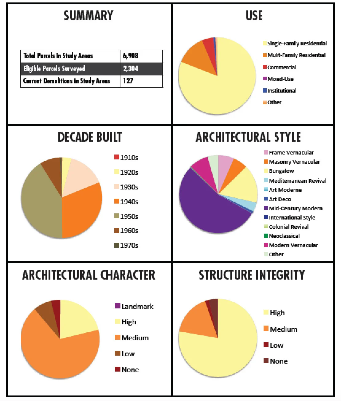
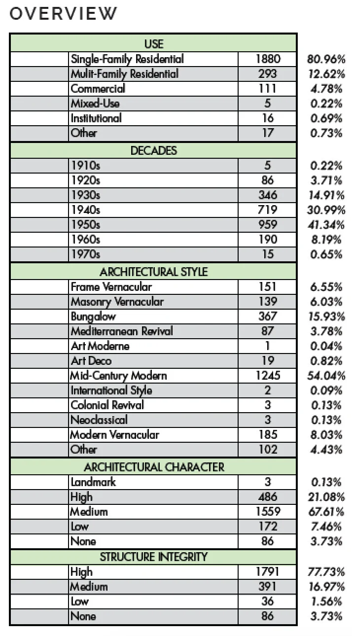
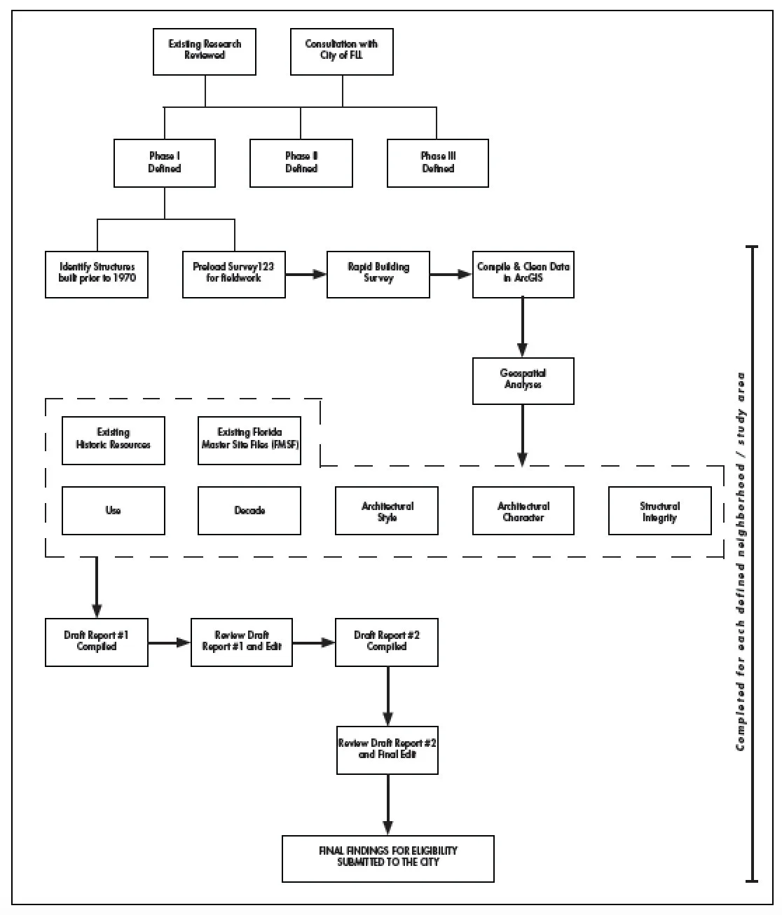
Under Phase I, this comprehensive survey completed initial reconnaissance-level fieldwork and geospatial analysis across eight study areas encompassing 2,304 individual parcels. The resulting 316-page report provides the City with a foundational tool to enable the community to identify, promote, and encourage the preservation and use of historic resources in support of Neighborhood Enhancement objectives. The primary goal of the survey was to identify architecturally and culturally significant resources warranting future in-depth research for potential local and national historic district designation, as well as potential individual historic landmarks. The effort included a review of prior survey work and research into historic development patterns. Through this process, twenty area or neighborhood associations were identified and organized into three survey phases.
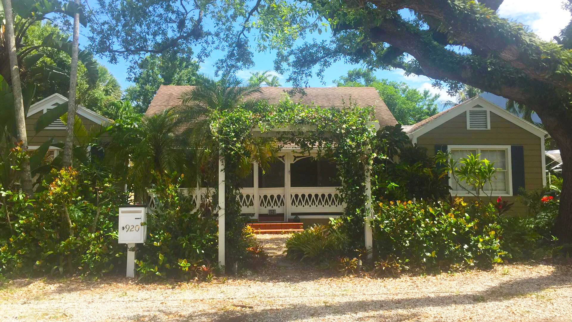
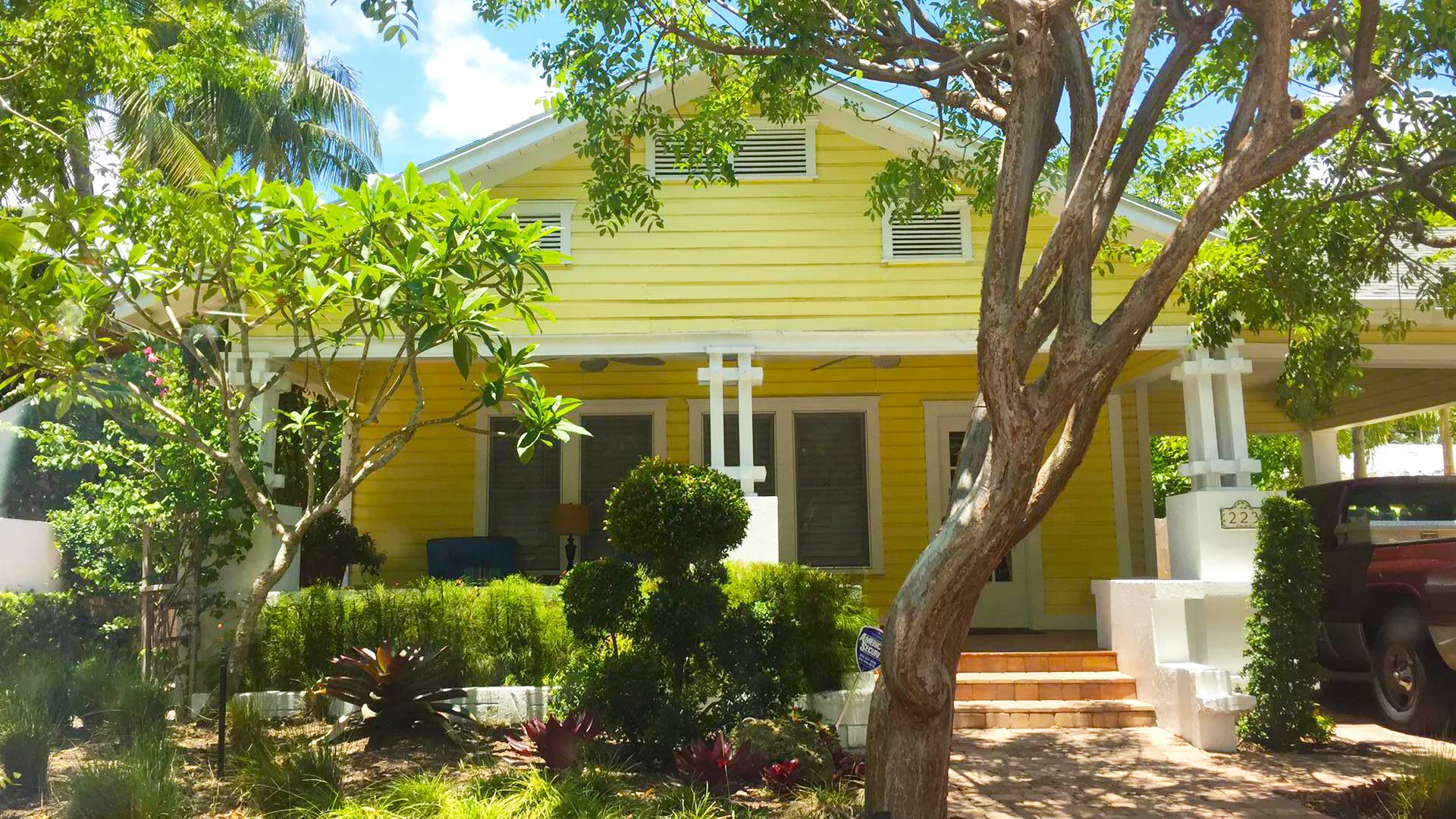
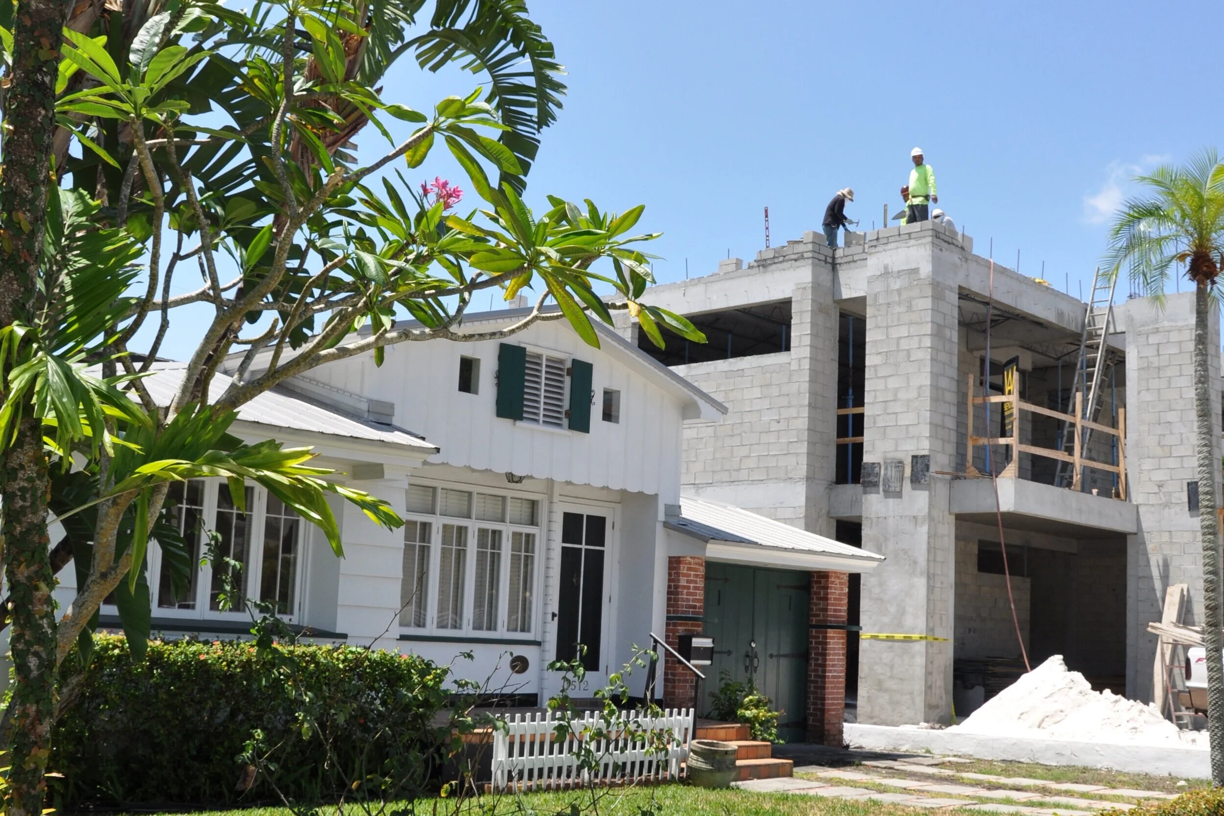
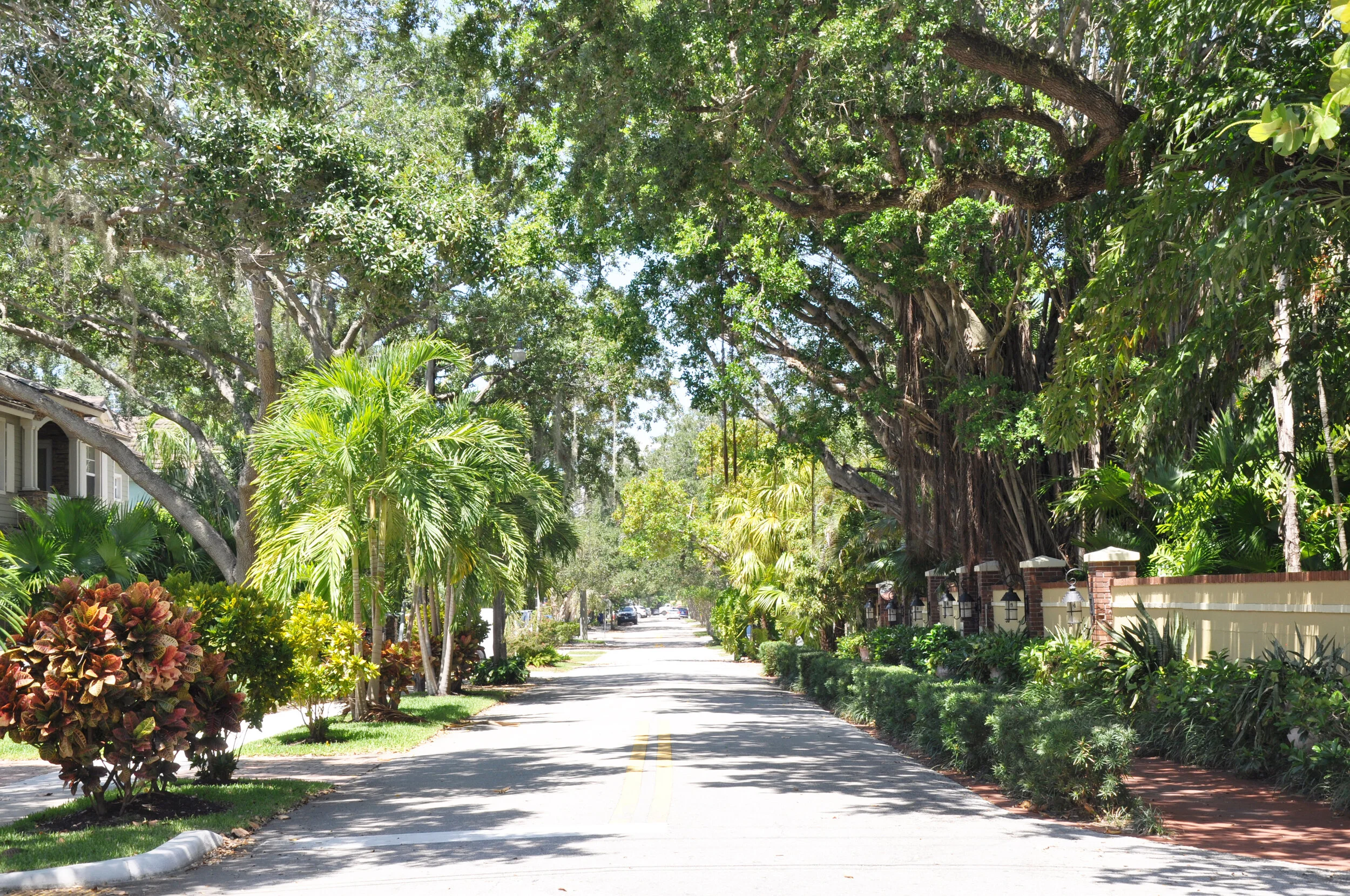
Phase I included reconnaissance-level surveys and geospatial analyses for eight areas. Field visits were conducted over a six-month period, and the study areas were further refined through geospatial analysis to maximize project efficiency. During Phase I, the City of Fort Lauderdale Architectural Resource Survey identified and evaluated approximately 3,651 individual resources and eight potential historic districts. All resources were examined and photographed from the exterior. The final Phase I findings include 2,304 historic resources comprising four historic districts, three reduced historic districts, two neighborhoods containing individually significant historic resources, and one area recommended for the development of design guidelines. Fieldwork remains a critical component of the historic preservation process, as it enables the identification, documentation, and evaluation of historic and architectural resources within defined thematic and geographic contexts. To support efficient field assessments, existing geospatial data were integrated into a rapid building survey developed using ArcGIS, allowing for streamlined data collection and analysis in the field.